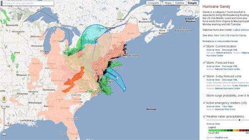
Hurricane Sandy Evolution Can be Seen by Google Maps:Google Maps allows users to see the evolution of Sandy Hurricane 2012 on its way through the U.S. east coast. Users can see where Hurricane Sandy at all times, forecasts, alerts or emergency shelters.

The category one hurricane Sandy continues to gain strength as it moves toward the East Coast of the United States, which has already led to the closure of thousands of schools and public and private institutions and the suspension of transportation services, reported by the National Center U.S. hurricanes.
To allow users to always know the evolution of Sandy, Google has enabled CrisisMaps tool in Google Maps. This map allows users to learn about the development of the severe storm, something that Google has already developed in other similar occasions.
Among the options available in this map, users can see where Sandy at all times, forecasts, alerts, emergency shelters assets, traffic conditions in the area as well as photographs and videos from YouTube, among others.
In addition, Google has created a crisis specific map of the city of New York showing the degree of flood risk neoyorkinas evacuation zones, plus specific evacuation centers, notices the National Hurricane Center, tips to prepare for a Hurricane, pictures, videos and webcams.
Watch Hurricane Sandy 2012 at Google Map


